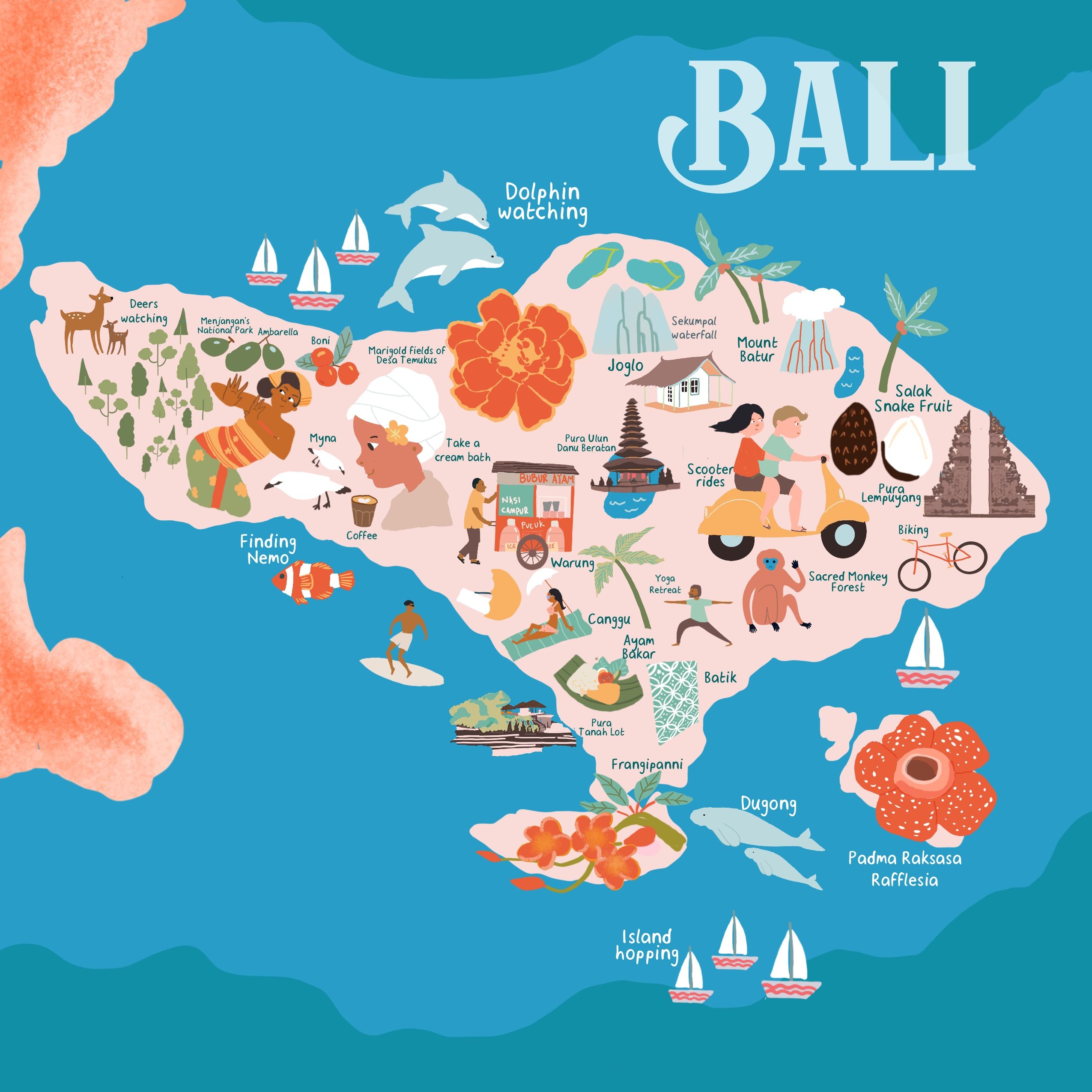
Planning a trip to the “Island of the Gods” can be overwhelming given the sheer diversity of its landscapes. Whether you are chasing world-class surf, serene yoga retreats, or hidden jungle waterfalls, understanding the geography is the first step to a perfect holiday. This Bali map with districts and areas explained will help you visualize the island’s layout and choose the perfect base for your 2026 adventure.
Navigating Bali: The Regional Layout
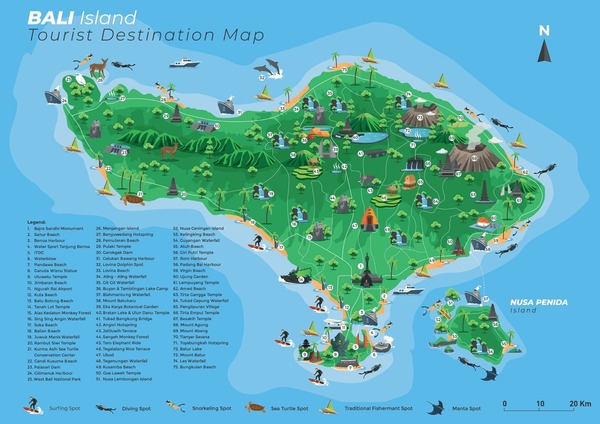
Bali is divided into several administrative regencies, each offering a distinct vibe. While the South is the bustling heart of tourism, the North, East, and West offer untouched nature and authentic cultural experiences.
By familiarizing yourself with a comprehensive Bali map with districts and areas explained, you can save hours of travel time. Traffic in Bali can be dense, so staying in the right district for your planned activities is crucial for an efficient itinerary.
The South: Where the Action Happens
The South is the most popular region for international travelers. It is home to the international airport (DPS) and the island’s most famous beach clubs and shopping districts. A detailed Bali map with districts and areas explained highlights these bustling southern areas.
Seminyak & Canggu: These are the trendsetters. Known for vibrant nightlife, luxury villas, and surf-heavy beaches, these areas are perfect for those who want to be in the center of the social scene.
Kuta & Legian: The historic heart of Bali tourism. These areas remain highly popular for budget travelers, surf schools, and proximity to massive shopping malls.
Uluwatu (The Bukit Peninsula): Famous for dramatic limestone cliffs, world-class surf breaks, and the iconic Uluwatu Temple. It offers a more rugged, upscale atmosphere compared to the busy streets of Canggu.
Central Bali: The Cultural & Spiritual Heart
If you move inland, you reach the cultural soul of the island. This region is defined by lush landscapes, ancient temples, and the famous Tegalalang Rice Terraces. Exploring Central Bali on a Bali map with districts and areas explained reveals its unique blend of nature and spirituality.
Ubud: The undisputed capital of culture and wellness. Ubud is surrounded by rainforests, terraced rice paddies, and traditional craft villages. It is the go-to spot for yoga enthusiasts, digital nomads, and those seeking a spiritual retreat.
Bedugul: Located in the central highlands, this area is significantly cooler. It is home to the stunning Ulun Danu Beratan Temple, which appears to float on a lake, making it a photographer’s paradise.
East & North Bali: Exploring the Untouched
For travelers looking to escape the crowds, the East and North coasts provide a glimpse into the “Old Bali.” The less-traveled paths of East and North Bali are clearly marked on any good Bali map with districts and areas explained, guiding you to serene spots.
Amed (East Bali): Known for its black volcanic sand beaches and world-class diving. Amed is peaceful, authentic, and offers incredible views of Mount Agung, the island’s highest volcano.
Lovina (North Bali): Famous for its dolphin-watching tours and calm, gentle waves. It is a sleepy, charming coastal strip that feels worlds away from the southern chaos.
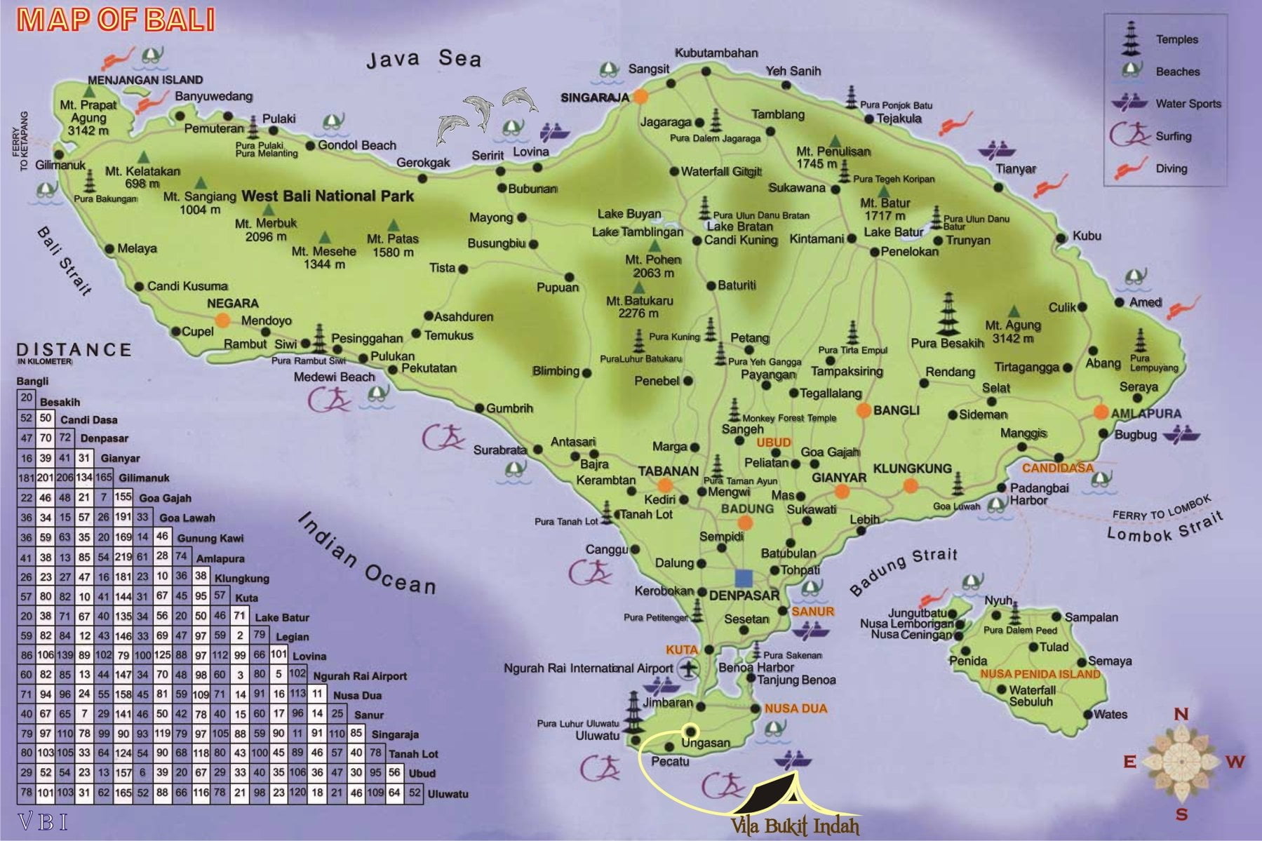
West Bali: Nature and Wild Landscapes
The West is often overlooked by short-term visitors, but it is a treasure trove for nature lovers. Consulting a Bali map with districts and areas explained can help you discover the wild beauty of West Bali, including its national park.
West Bali National Park: This is the only national park on the island. It is a protected area where you can hike through savannas, mangroves, and pristine coral reefs near Menjangan Island. It is perfect for bird watchers and those who prefer an off-the-beaten-path experience.
Tips for Planning Your 2026 Bali Itinerary
When using a comprehensive Bali map with districts and areas explained to plan your trip, keep these expert tips in mind:
- Factor in Travel Time: Even if two locations look close on a map, local road conditions and heavy traffic can make travel take longer than expected. Always add a 30-60 minute buffer to your transit estimates.
- Combine Regions: Split your stay! Spend 3-4 days in the South for beach vibes and shopping, then head to Ubud for 3-4 days to soak in the culture and jungle scenery.
- Rent a Scooter Wisely: While popular, only rent a scooter if you are an experienced rider and possess an international driver’s permit. Otherwise, use ride-hailing apps like Gojek or Grab for safe, affordable transit.
- Stay Updated: In 2026, many areas are implementing new digital tourist tax systems and improved infrastructure. Check local government tourism portals before your departure to stay informed.
Conclusion: Making the Most of Your Bali Journey
Understanding the Bali map with districts and areas explained is the key to unlocking the true potential of your vacation. Whether you crave the high-octane energy of the southern beach clubs or the meditative silence of the central highlands, there is a district in Bali tailored for you.
By grouping your activities by region and respecting the geography of the island, you ensure that your 2026 trip is less about staring at a map and more about soaking in the magical atmosphere of Indonesia’s most beloved island. Happy travels!